CARES GORGE
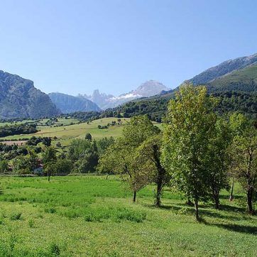
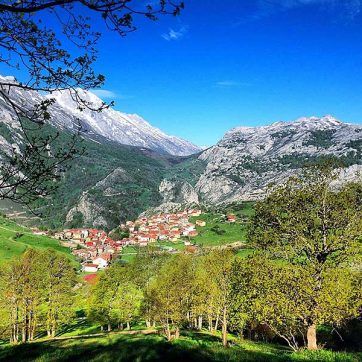
The Cares Gorge, also called the “Divine Gorge”, is one of the most famous walking routes in the Picos, and crosses between the provinces of León and Asturias. The walkway was built to allow maintenance of the water canal that runs the length of the Cares Gorge. The canal was built between 1916 and 1921 to carry water for the hydro scheme power station in Poncebos. As well as the spectacular landscape, the gorge has significant botanical and geological interest.
ITINERARY DESCRIPTION
3 hrs. one way.
6 hrs. one way.
12 km one way, 24 km both ways.
ACCESS TO THE CARES GORGE AND THE BULNES FUNICULAR
During Easter and August, once available parking in Poncebos is full, vehicles must be parked in the Ovar parking, with 146 spaces, located 1.2 km from Poncebos. If this parking is full then parking is available in Llaneces (Arenas de Cabrales). There are bus services from both car parks to Poncebos (www.alsa.es).
There are four further villages in the National Park that can be accessed by car from Poncebos: Camarmeña, Tielve, Sotres and Tresviso.
ITINERARY DESCRIPTION
3 hrs. one way.
6 hrs. one way.
12 km one way, 24 km both ways.
ACCESS TO THE CARES GORGE AND THE BULNES FUNICULAR
During Easter and August, once available parking in Poncebos is full, vehicles must be parked in the Ovar parking, with 146 spaces, located 1.2 km from Poncebos. If this parking is full then parking is available in Llaneces (Arenas de Cabrales). There are bus services from both car parks to Poncebos (www.alsa.es).
A través de Poncebos se puede acceder a otras cuatro localidades existentes en el interior del Parque Nacional, Camarmeña, Tielve, Sotres y Tresviso, y para ellas no existe limitación de paso.
HOW TO GET THERE
CAÍN (León):
If you come from León, go to Riaño, and then head towards Puerto del Pontón on the N-625 until the road that goes to Posada de Valdeón (LE-2711) and Caín. If you come from Asturias, take the N-625 from Cangas de Onís, going in the direction of the pass Puerto del Pontón. One kilometre after the pass, you will find the same road to Posada de Valdeón and Caín.
PONCEBOS (Asturias):
If you come from Cantabria or Cangas de Onís, take the AS-114 to Arenas de Cabrales. In this village, take the AS-264, and drive for 5 km to Poncebos.
INFORMATION OF INTEREST
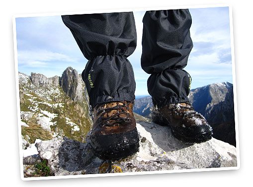
- Take mountain footwear.
- It is very important to take plenty of water and food. There’s no water available on the 12- kilometre walk, apart from in Poncebos and Caín, where you can find bars, restaurants, and hotels.
- It’s recommended to use sunscreen and a cap in summer, since the tunnels are the only areas with some shade.
- The walk is along cliffs with no side protection, and there is a risk of rock falls due to natural effects (rain, wind) or to animals grazing near the track. It is important to be alert, especially if the walk is done with children.
- Dogs are allowed, but they must be on a leash.
- Riding mountain bikes is not allowed.
- If you start the walk in Poncebos, you will find that the first 2 km are uphill. If you’re planning to only walk a part of the gorge, we suggest you start in Caín to avoid this uphill part and to walk the section with the tunnels, which is the most spectacular.
ITINERARY DESCRIPTION
3 hrs. one way.
3 hrs. both ways.
12 km one way, 24 km both ways.
ACCESS TO THE CARES GORGE AND THE BULNES FUNICULAR
During Easter and August, once available parking in Poncebos is full, vehicles must be parked in the Ovar parking, with 146 spaces, located 1.2 km from Poncebos. If this parking is full then parking is available in Llaneces (Arenas de Cabrales). There are bus services from both car parks to Poncebos (www.alsa.es).
There are four further villages in the National Park that can be accessed by car from Poncebos: Camarmeña, Tielve, Sotres and Tresviso.
HOW TO GET THERE
CAÍN (León):
If you come from León, go to Riaño, and then head towards Puerto del Pontón on the N-625 until the road that goes to Posada de Valdeón (LE-2711) and Caín. If you come from Asturias, take the N-625 from Cangas de Onís, going in the direction of the pass Puerto del Pontón. One kilometre after the pass, you will find the same road to Posada de Valdeón and Caín.
PONCEBOS (Asturias):
If you come from Cantabria or Cangas de Onís, take the AS-114 to Arenas de Cabrales. In this village, take the AS-264, and drive for 5 km to Poncebos.
INFORMATION OF INTEREST
- Take mountain footwear.
- It is very important to take plenty of water and food. There’s no water available on the 12- kilometre walk, apart from in Poncebos and Caín, where you can find bars, restaurants, and hotels.
- It’s recommended to use sunscreen and a cap in summer, since the tunnels are the only areas with some shade.
- The walk is along cliffs with no side protection, and there is a risk of rock falls due to natural effects (rain, wind) or to animals grazing near the track. It is important to be alert, especially if the walk is done with children.
- Dogs are allowed, but they must be on a leash.
- Riding mountain bikes is not allowed.
- If you start the walk in Poncebos, you will find that the first 2 km are uphill. If you’re planning to only walk a part of the gorge, we suggest you start in Caín to avoid this uphill part and to walk the section with the tunnels, which is the most spectacular.
RELATED PACKAGES
MARKED WALKS
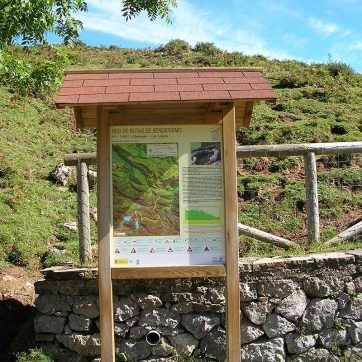
The National Park has a network of trails that are marked as short walks (PR) or long walks (GR).
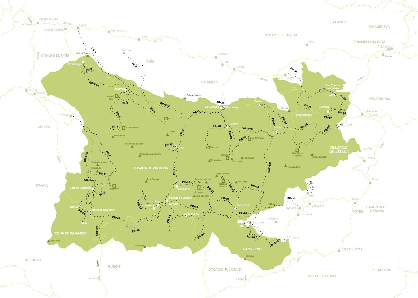
SHORT WALKS (PR)
KML short/ KML long
KML Buferrera-Vegarredonda/ KML Vegarredonda-Ordiales
PR-PNPE 7. La Jocica-Carombo. 17.5 km. 6 hrs. 550-m elevation change. Medium difficulty.
PR-PNPE 8. Demués-Los Lagos. 10.1 km. 3.5 hrs. 700-m elevation change. Medium difficulty.
PR-PNPE 9. Soto de Sajambre-Vegabaño. 9.8 km. 3 hrs. 390-m elevation change. Medium difficulty.
KML
PR-PNPE 10. Pueblos de Sajambre. 13.8 km. 4.5 hrs. 600-m elevation change. Low difficulty.
PR-PNPE 11. Panderruedas-Posada del Valdeón. 13.5 km. 4 hrs. 511-m elevation change. Low difficulty.
KML
PR-PNPE 12. Vega de Llos. 12 km. 5 hrs. 596-m elevation change. Medium difficulty.
KML
PR-PNPE 13. Cueva de Santibañas. 4.3 km. 2.5 hrs. 500-m elevation change. Low difficulty.
KML short/ KML long
PR-PNPE 14. Montó (Prada Valley). 4.3 km. 2.5 hrs. 500-m elevation change. Low difficulty.
KML from Prada/ KML from Santa Marina
PR-PNPE 15. Senda del Mercadillo. 15 km. 5.5 hrs. 832-m elevation change. Medium-high difficulty.
KML from Santa Marina/ KML from Posada
KML
PR-PNPE 22. Peña Oviedo (El Cable-Mogrovejo). 10 km. 3 hrs. 700-m elevation change. Low difficulty.
KML
PR-PNPE 23. Horcados Rojos. 11 km. 4.5 hrs. 510-m elevation change. Medium-high difficulty.
KML
PR-PNPE 24. Puertos de Áliva. 13.3 km. 5 hrs. 970-m elevation change. 855-m elevation change. Medium difficulty.
PR-PNPE 25. Vega de Liordes. 11 km. 5.5 hrs. 970-m elevation change. High difficulty.
PR-PNPE 26. Hayedo de Las Ilces. 10.2 km. 4.5 hrs. 300-m elevation change. Low difficulty.
PR-PNPE 27. Brez-Canal de Arredondas. 5.4 km. 2 hrs. 220-m elevation change. Low difficulty.
PR-PNPE 28. Macizo de Ándara. 25 km. 7.5 hrs. 1 110-m elevation change. Medium-high difficulty.
PR-PNPE 29. Pasá del Picayo. 6.7 km. 4 hrs. 730-m elevation change. High difficulty.
PR-PNPE 30. Urdón-Tresviso. 13.6 km. 5 hrs. 830-m elevation change. High difficulty.
PR-PNPE 31. Camarmeña. 2 km. 2 km. 1.5 hrs. 200-m elevation change. Low difficulty.
PR-PNPE 32. Pandetrave-Collado Jermoso. 11.9 km. 6.5 hrs. 800-m elevation change. High difficulty.
PR-PNPE 33. Panderruedas-Oseja de Sajambre. 6.4 km. 2 hrs. 708-m elevation change. Low difficulty.
PR-PNPE 34. Oceño-San Esteban de Cuñaba. 11.2 km. 5 hrs. 990-m elevation change. Medium-high difficulty.
LONG WALKS (GR)
GR-202. Ruta de la Reconquista (Covadonga-Cosgaya). 58.6 km. 20.5 hrs. 1 050-m elevation change. High difficulty.
RELATED PACKAGES
A via ferrata is a vertical or horizontal itinerary equipped with different material (bolts, metal rung steps, holds, hand lines, chains, hanging bridges, and cable walkways) that allows walkers and non-climbers to access difficult areas safely. Security is provided by a steel rope installed the length of the via ferrata that you are secured to, using carabiners connected to energy dissipating lanyards attached to the safety harness worn.
LA HERMIDA GORGE
La Hermida, Peñarrubia (CANTABRIA)
La Hermida, Peñarrubia (CANTABRIA): These via ferratas have an 800-m elevation change, and are almost 6 km long. They follow a trail that shepherds used to take goats from the low areas of the gorge to Cueva Ciloña. There are four vias, and can be done individually or altogether. There is a 45-m Tibetan bridge and the longest wooden hanging footbridge in a via ferrata in Spain (90 m long and more than 100 m high). The descent is made following a trail that goes through a holm oak forest until arriving to the starting point again, the Hermida Gorge. The access is free of charge, but material and the services of a guide can be hired nearby.
LOS BEYOS GORGE
Puente Vidosa, Ponga (ASTURIAS)
The Vidosa Multiadventure Park has seven via ferratas, seven zip-lines, four different Tibetan bridges, a climbing wall, abseils, and areas to practice climbing.
To access the via ferratas, you must pay 6€ to enter the Adventure Park, which has itineraries of various difficulties. To descend, you can pay to use any of the installed zip-lines, as well as hire material or the services of a guide.
LOS LLANOS
Camaleño (CANTABRIA)
This via ferrata has two options: One that joins the three main walls that go to the summit, and a more complicated one that, halfway up the third wall, goes with difficulty towards a Tibetan bridge, and has a challenging exit on a steep wall to the summit.
For this second option, it is essential to be experienced and/or hire the services of a guide. It is a 190-m ascent and a 240-m descent, with an elevation change of 160 m. The via goes to different walls that are connected through the safety line. There are horizontal sections where it’s necessary to do some crossings. There is a medium-levelled section and another section for beginners.
Users do this activity under their own responsibility, since it’s a free entry and a free of charge access. The minimum safety equipment required is a helmet, a safety harness, and a double-anchored lanyard with carabiners and a via ferrata certified shock absorbing device. People without this material can hire it at the reception centre. The area has been equipped with climbs of grades III-V to enjoy and complete a good day’s activity.
VALDEÓN FERRATA
Cordiñanes (LEÓN)
Via ferrata managed by the local government of Valdeón, consisting of 1200 m of routes of various difficulty levels. The access is free, but prior registration is necessary, because from April to July access is restricted to 50 people per day. The local government has a website with a system to confirm registrations and validate access on completion of a personal information form. Access is prohibited for children under 10 years old. The groups using the via ferrata cannot be of more than 6 members, and need to keep 15-minute gaps between each of them for security. It can be used an hour after sunrise and up to an hour before sunset, based on the official timetables of Orto y Ocaso (AEMET). You can hire material and the services of a guide in the area.
LA HERMIDA GORGE
La Hermida, Peñarrubia (CANTABRIA)
La Hermida, Peñarrubia (CANTABRIA): These via ferratas have an 800-m elevation change, and are almost 6 km long. They follow a trail that shepherds used to take goats from the low areas of the gorge to Cueva Ciloña. There are four vias, and can be done individually or altogether. There is a 45-m Tibetan bridge and the longest wooden hanging footbridge in a via ferrata in Spain (90 m long and more than 100 m high). The descent is made following a trail that goes through a holm oak forest until arriving to the starting point again, the Hermida Gorge. The access is free of charge, but material and the services of a guide can be hired nearby.
LOS BEYOS GORGE
Puente Vidosa, Ponga (ASTURIAS)
Para acceder de forma libre a estas vías ferrata hay que pagar 6€ por entrar al Parque de Aventura, que consta de varios itinerarios de diferentes dificultades. Para bajar se pueden utilizar mediante pago cualquiera de las tirolinas instaladas, así como alquilar material o guía.
LOS LLANOS
Camaleño (CANTABRIA)
This via ferrata has two options: One that joins the three main walls that go to the summit, and a more complicated one that, halfway up the third wall, goes with difficulty towards a Tibetan bridge, and has a challenging exit on a steep wall to the summit.
For this second option, it is essential to be experienced and/or hire the services of a guide. It is a 190-m ascent and a 240-m descent, with an elevation change of 160 m. The via goes to different walls that are connected through the safety line. There are horizontal sections where it’s necessary to do some crossings. There is a medium-levelled section and another section for beginners.
Users do this activity under their own responsibility, since it’s a free entry and a free of charge access. The minimum safety equipment required is a helmet, a safety harness, and a double-anchored lanyard with carabiners and a via ferrata certified shock absorbing device. People without this material can hire it at the reception centre. The area has been equipped with climbs of grades III-V to enjoy and complete a good day’s activity.
VALDEÓN FERRATA
Cordiñanes (LEÓN)
Via ferrata managed by the local government of Valdeón, consisting of 1200 m of routes of various difficulty levels. The access is free, but prior registration is necessary, because from April to July access is restricted to 50 people per day. The local government has a website with a system to confirm registrations and validate access on completion of a personal information form. Access is prohibited for children under 10 years old. The groups using the via ferrata cannot be of more than 6 members, and need to keep 15-minute gaps between each of them for security. It can be used an hour after sunrise and up to an hour before sunset, based on the official timetables of Orto y Ocaso (AEMET). You can hire material and the services of a guide in the area.
CIRCUIT OF THE PICOS
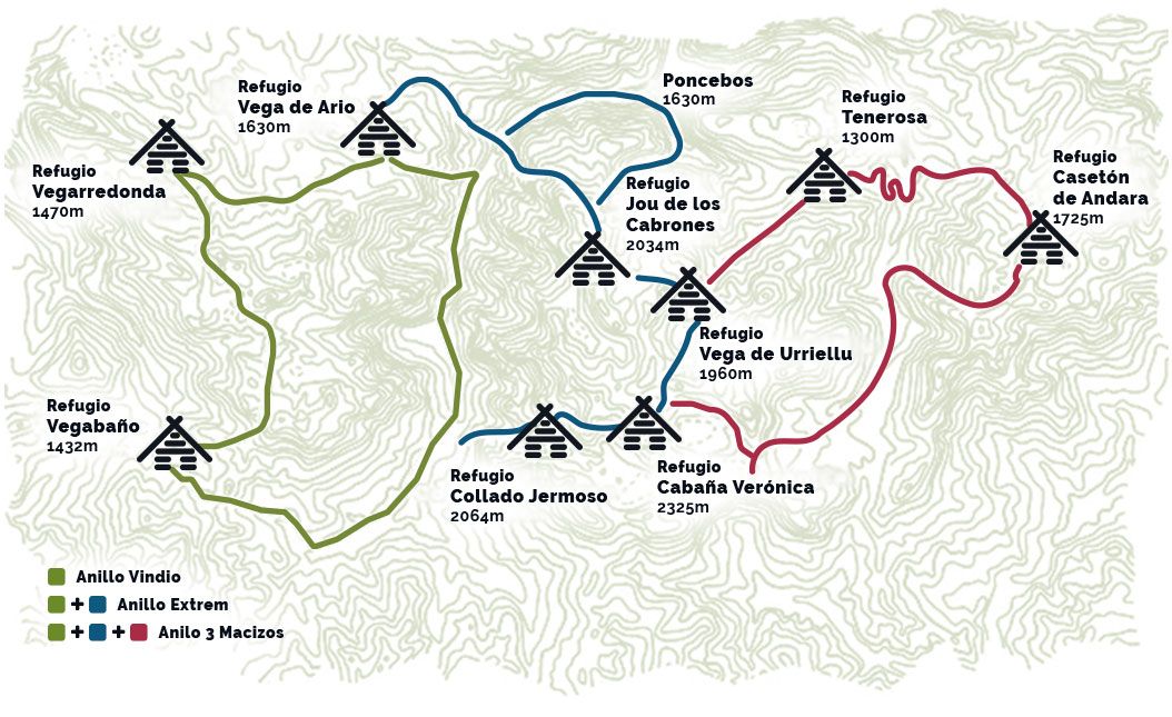
The Circuit of the Picos is a circular route that joins the mountain huts in the Picos, revealing all the National Park has to offer. Each of the stages starts from a collaborating mountain hut or accommodation, and finishes in a different one. The advantage is you’re not obliged to begin in a specific place, and can choose where to start from. It has an elevation change of 9 000 m and a total distance of 115 km.
To monitor and follow progress of your trip, there is a passport you can buy in any of the mountain huts (3€), which can be stamped by the hut wardens indicating the date and time you got there. It’s not obligatory to stay overnight, but it is recommended in many cases due to the difficulty and duration of some stages. You can also buy the circuit pack (30€) with a T-shirt, a passport, a special map of the circuit, and a buff, so you can take a souvenir of the route.
You have three options to do the circuit that we describe next…
THE DIFFERENT CIRCUITS
VINDIO CIRCUIT
Difficulty:Medium
Route:
Western Massif of the Picos de Europa.
Ascent:3.900 m.
Distance:63 km.
Access from::
Cangas de Onís, Sajambre or Valdeón.
Timings Guide:
- Valdeón-Ario: 6 hours.
- Ario-Vegarredonda: 4-6 hours.
- Vegarredonda-Vegabaño: 8-10 hours.
- Vegabaño-Valdeón: 4 hours.
“EXTREM” CIRCUIT
Difficulty:High
Route:
Western and Central Massifs of the Picos de Europa.
Ascent: 7.050 m.
Distance: 82 km.
Access from:
Cangas de Onís, Sajambre, Valdeón, Liébana and Cabrales.
Timings Guide:
- Valdeón-Jermoso: 4 hours.
- Jermoso-Verónica: 3 hours.
- Verónica-Urriello: 3 hours.
- Urriello-Cabrones: 4 hours.
- Cabrones-Bulnes: 4 hours.
- Bulnes-Ario: 3 hours.
- Ario-Vegarredonda: 4-6 hours.
- Vegarredonda-Vegabaño: 8-10 hours.
- Vegabaño-Valdeón: 4 hours.
THREE MASSIFS CIRCUIT
Difficulty:Very high
Route:
Western, Central, and Eastern Massifs of the Picos de Europa.
Ascent: 9.350 m.
Distance: 110 km.
Access from:
Cangas de Onís, Sajambre, Valdeón, Liébana, Cabrales and Sotres.
Timings Guide:
- Valdeón-Jermoso: 4 hours.
- Jermoso-Verónica: 3 hours.
- Verónica-Liébana: 1 hours.
- Liébana-Ándara: 7-8 hours.
- Ándara-Urriellu: 6 hours.
- Urriellu-Cabrones: 3 hours.
- Cabrones-Bulnes: 4 hours.
- Bulnes-Ario: 8 hours.
- Ario-Vegarredonda: 4-6 hours.
- Vegarredonda-Vegabaño: 8-10 hours.
- Vegabaño-Valdeón: 4 hours.
“EXTREM” CIRCUIT
Difficulty:Medium
Route:
Western Massif of the Picos de Europa.
Ascent:3.900 m.
Distance:63 km.
Access from:
Cangas de Onís, Sajambre or Valdeón.
Horarios:
- Valdeón-Ario: 6 hours.
- Ario-Vegarredonda: 4-6 hours.
- Vegarredonda-Vegabaño: 8-10 hours.
- Vegabaño-Valdeón: 4 hours.
VINDIO CIRCUIT
Difficulty:High
Route:
Western and Central Massifs of the Picos de Europa.
Ascent: 7.050 m.
Distance: 82 km.
Access from:
Cangas de Onís, Sajambre, Valdeón, Liébana and Cabrales.
Timings Guide:
- Valdeón-Jermoso: 4 hours.
- Jermoso-Verónica: 3 hours.
- Verónica-Urriello: 3 hours.
- Urriello-Cabrones: 4 hours.
- Cabrones-Bulnes: 4 hours.
- Bulnes-Ario: 3 hours.
- Ario-Vegarredonda: 4-6 hours.
- Vegarredonda-Vegabaño: 8-10 hours.
- Vegabaño-Valdeón: 4 hours.
THREE MASSIFS CIRCUIT
Difficulty:Very High
Route:
Western, Central, and Eastern Massifs of the Picos de Europa.
Ascent: 9.350 m.
Distance: 110 km.
Access from:
Cangas de Onís, Sajambre, Valdeón, Liébana, Cabrales and Sotres
Timings Guide:
- Valdeón-Jermoso: 4 hours.
- Jermoso-Verónica: 3 hours.
- Verónica-Liébana: 1 hours.
- Liébana-Ándara: 7-8 hours.
- Ándara-Urriellu: 6 hours.
- Urriellu-Cabrones: 3 hours.
- Cabrones-Bulnes: 4 hours.
- Bulnes-Ario: 8 hours.
- Ario-Vegarredonda: 4-6 hours.
- Vegarredonda-Vegabaño: 8-10 hours.
- Vegabaño-Valdeón: 4 hours.
INFORMATION OF INTEREST
RECOMMENDATIONS
RECOMMENDATIONS TO WALK IN THE NATIONAL PARK
It is possible to walk in almost all the National Park, except in Reserve Areas, where it is limited to the marked paths, trails, or climbing routes.
- Apart from the authorized use by locals or for regulated research activities, it is prohibited to collect specimens or natural materials, whether they’re animal, vegetal, or mineral.
- Return waste to civilization to recycle properly, limiting the use of bins. Nevertheless, remember it is prohibited to leave, deposit, or throw any type of waste outside bins and containers.
- Except for shepherd’s dogs and cattle, dogs and other domestic animals must be on a lead at all times and close to their owners.
- Except for the bathing areas that are denoted in and around local settlements and are properly signed, it is not allowed to bathe in lakes or rivers of the National Park.
- Always take a warm piece of clothing and adequate shoes. Cold can surprise you any moment, as well as rain.
- Be aware of your own fitness. If you have doubts on your physical capacity, you shouldn’t try walking a route that requires a large physical effort.
- Drinkable water can be scarce in summer and autumn, and water that is available is untreated It is therefore best to take enough water for the type of walk you do.
- Mist is the biggest concern when walking in the high mountains. You can often get sudden and very thick mist in the Picos.. Even if you think you know the area in which you are walking, it is best to wait until mist rises, and search for shelter before it closes in.
- It is always recommended to take sufficient food and snacks.
- If you get lost, it is best to look for a nearby shelter, and wait to be rescued.
- If you’re planning to walk in the mountains alone, you should let people in the mountain huts know, leave a notice on the dashboard of your car, and/or let your family know the itinerary and the amount of time you plan to be walking.
